
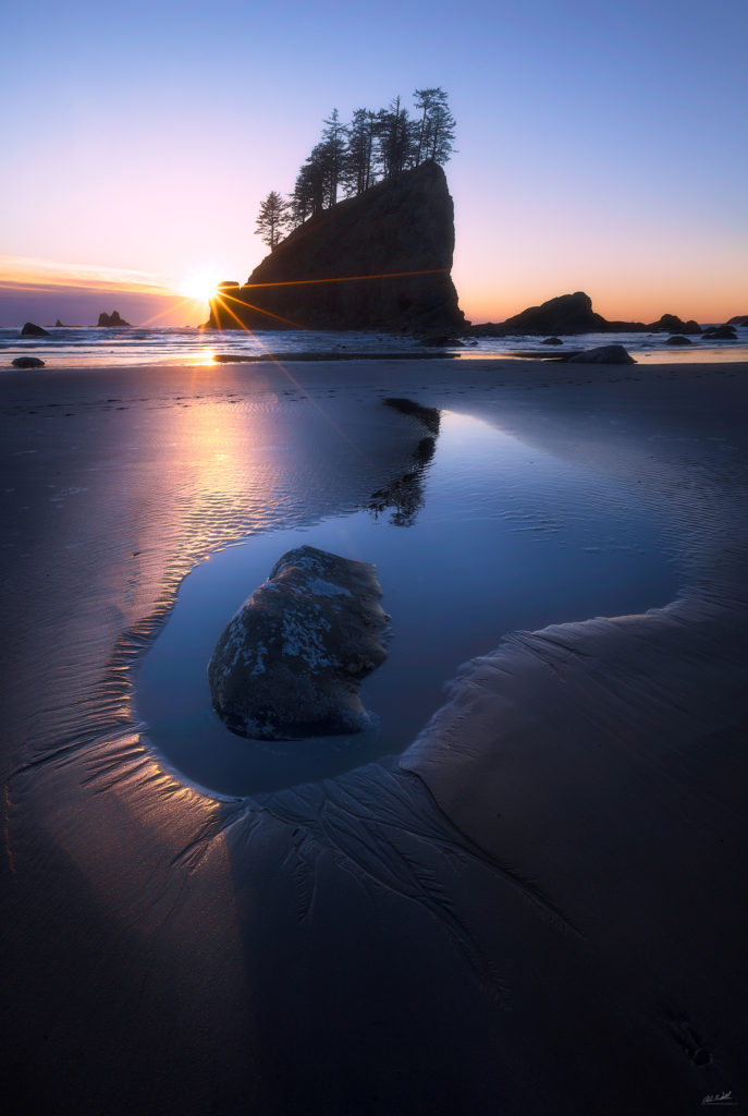
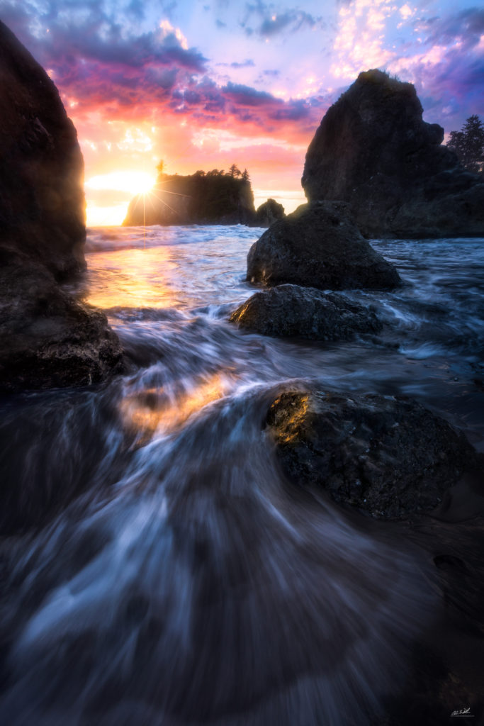
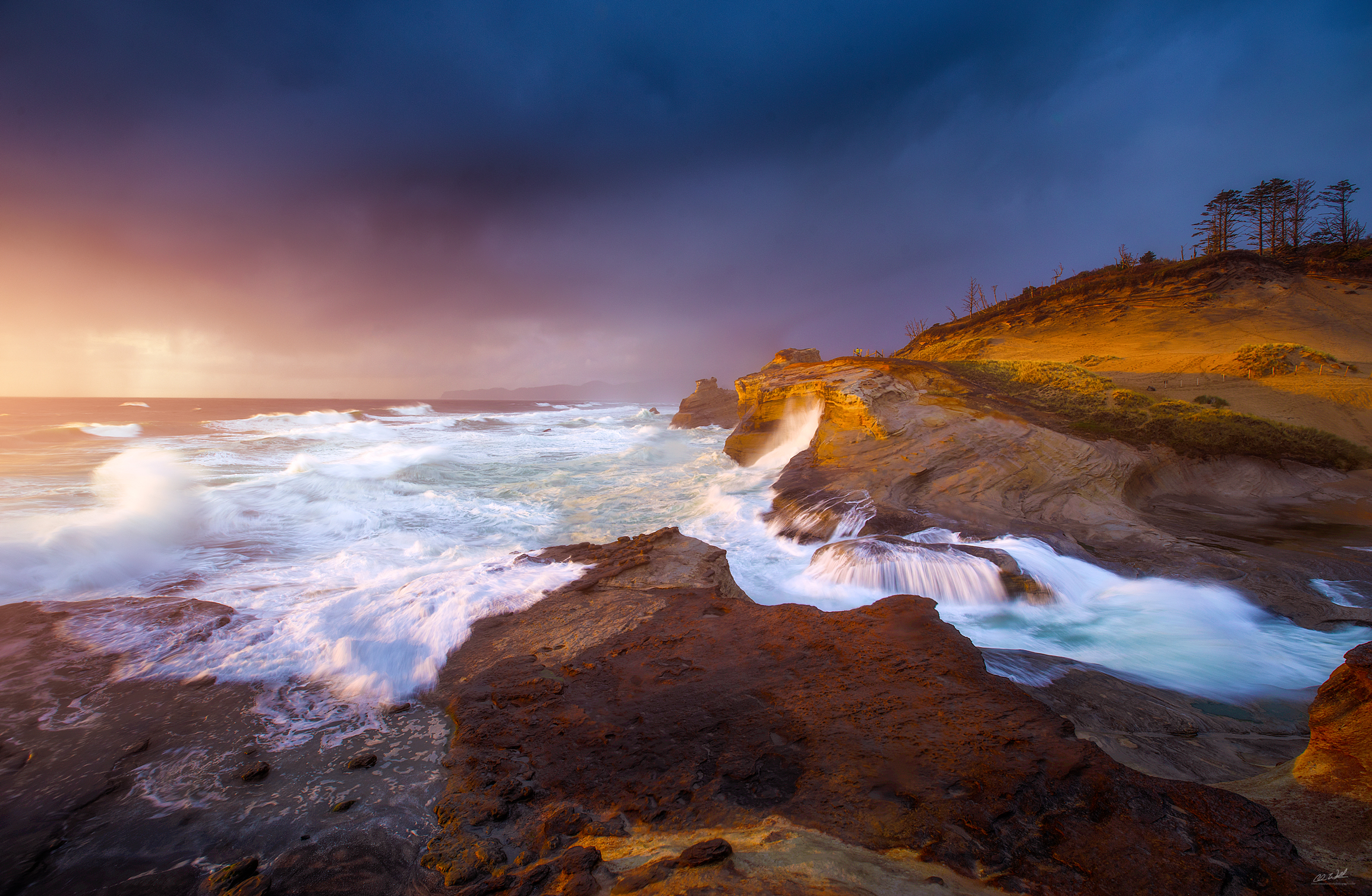
Predicting Sunsets and Sunrises in the Pacific Northwest
Predicting the weather is never an easy task; especially when it comes to landscape photography. We all hunger to capture epic light and 90% of the time it’s just a bust. The timing is off, the clouds disappear, the weather patterns shift or you just don’t have your gear with you which most of us landscape photographers refer to as getting #debreezied (thank David Thompson for that one)! On a serious note David’s an amazing landscape photographer; definitely check his work out! In any case getting the forecast right can be tricky and being at the right place at the right time can be even more tricky. There are a few different groups out there that now have algorithms that can predict with some certainty whether or not there will be epic light on any given day. Models are great and can be used as a guide, but I find checking traditional forecasts and knowing a few tips and tricks about living in the Pacific Northwest can help a great deal! In this blog post I’m going to try to outline the methods that I use to capture epic light. Sometimes they work and sometimes it’s a complete bust, but the majority of the time I have found that paying attention to the following small details can help to predict beautiful sunsets and unreal sunrises here in the Pacific Northwest.
Know the forecast
 Knowledge is power and understanding the weather forecast is crucial to predicting whether or not the light will be worth a trip to your favorite photography spot. Understanding how the jet stream works and how it impacts our weather is critical to forming a forecast. I’m not going to go into too much detail but think of the Jet Stream as an oceanic conveyor belt or river if you will. Large storms that form over the Pacific Ocean ride along this conveyor belt and make landfall up and down the West Coast. Pressure gradients appear as lines or bars on a weather map. If the lines or bars are close together that often means a strong low pressure system is in the area. When the lines or bars are far apart it means that high pressure is present. When high pressure in place it moves the ocean river or conveyor belt north or south of us. If the Jet Stream moves north we often get warmer weather. If it moves south we can sometimes get lowland snow events depending upon the Jet Stream’s orientation near our coast. The bottom line is this: High Pressure in general means poor conditions for sunsets and sunrises (especially on the coast). Any time you see high pressure present in our area you can almost be certain that no clouds will be present in the sky. That isn’t always a bad thing! Once in a while a cloudless sky can be beautiful when there are storms off of the coast or if a large atmospheric event is taking place like a volcanic eruption or a forest fire. Events such as those kick up particulates into the atmosphere and allow for some amazing hazy light. It should be noted though that pollution and fires can actually subdue colors. That’s why you often only see reds and yellows when the atmosphere is cluttered with too much particulate. I’ll go into that in more detail further on. Cloudless skies also offer incredible opportunities for night sky photography such as the milky way set against a stunning foreground like mountains and wild flowers. With that said clouds definitely do add interest to a photograph.

Pressure Gradients during a windstorm event. The closer the lines the lower the pressure is and the stronger the storm.
Cliff Mass is a very talented meteorologist that works for the University of Washington. He uses a variety of algorithms to help him predict the weather and he’s usually pretty spot on. I follow his weather blog and often check his extended precipitation forecasts as well.
I often use apps to help me predict the forecasts on the fly as well. As you know most of the time we landscape photographers are on the road so predicting the weather can get tricky. Luckily there are some pretty good apps out there for that! I use the NOAA Radar App, AccuWeather, Star Walk and Tides Near Me to help me predict star forecasts, weather forecasts and where the tides will be when I’m out on the coast. First and foremost I always consult the weather blogs I mentioned above and the National Weather Service-Seattle website to help plan my trips. Outside of using the current forecast models I rely on a few helpful tips and tricks that I’ve learned over the years. I’ll outline them in the following paragraphs.
Follow the Cold Front!
For those of us that live up here in the Pacific Northwest we know first hand that we often get some amazing sunsets and sunrises before and after a big storm. Strong cold fronts often leave instability in the atmosphere before pushing on shore and after passing through the region which can lead to some of the most amazing light you can photograph in the region. I always try to plan my trips to the mountains and to the coast around storms and unstable conditions in the atmosphere; sometimes that’s just not possible but if my schedule allows for it I do it.
Generally speaking any time a cold front or a vigorous weather system is forecasted to hit the Pacific Northwest there is a good chance that you will see beautiful light. It goes along with the old mariner saying: ‘Red sky at morning, sailors take warning’. The red skies are caused by particulates and clouds in the atmosphere that are churned up by strong storm systems. The more ‘stuff’ that gets kicked up by the storms the more color you will see during sunrise and sunset. This occurs because as the sun sits lower on the horizon the angle of the light is such that it enters more and more of our atmosphere. As light shines through the dust, water and other particles it is scattered and emitted at different wavelengths and we get gorgeous colors as a result. Pure air often results in a much more colorful sunset. Ordinary sunlight is composed of a spectrum of colors that are graded from violets and blues at one end of the spectrum to oranges and reds on the other. Air molecules are slightly closer in size to the wavelength of violet light than to that of red light. Since pure air scatters violet light three to four times more effectively than it does the longer wavelengths the result of this is gorgeous colors during sunrise and sunset light.
The general rule of thumb that I go by is to follow the cold front! If you know a strong low pressure system or storm is approaching set yourself up to photograph the gorgeous light that precedes and follows the system.
Clouds! (in small doses)
Clouds can be a photographer’s dream or their worst nightmare. It’s all in the cloud type and the timing. Clouds act like an amplifier for light; they catch it and reflect it in gorgeous colors and tones. Typically we see that higher clouds like cirrus and altocumulus absorb color the best because the light is unfiltered at higher altitudes; it hasn’t already passed through the dust and dirt in the lower portions of Earth’s atmosphere. An example of this can be seen in the photo to the left. 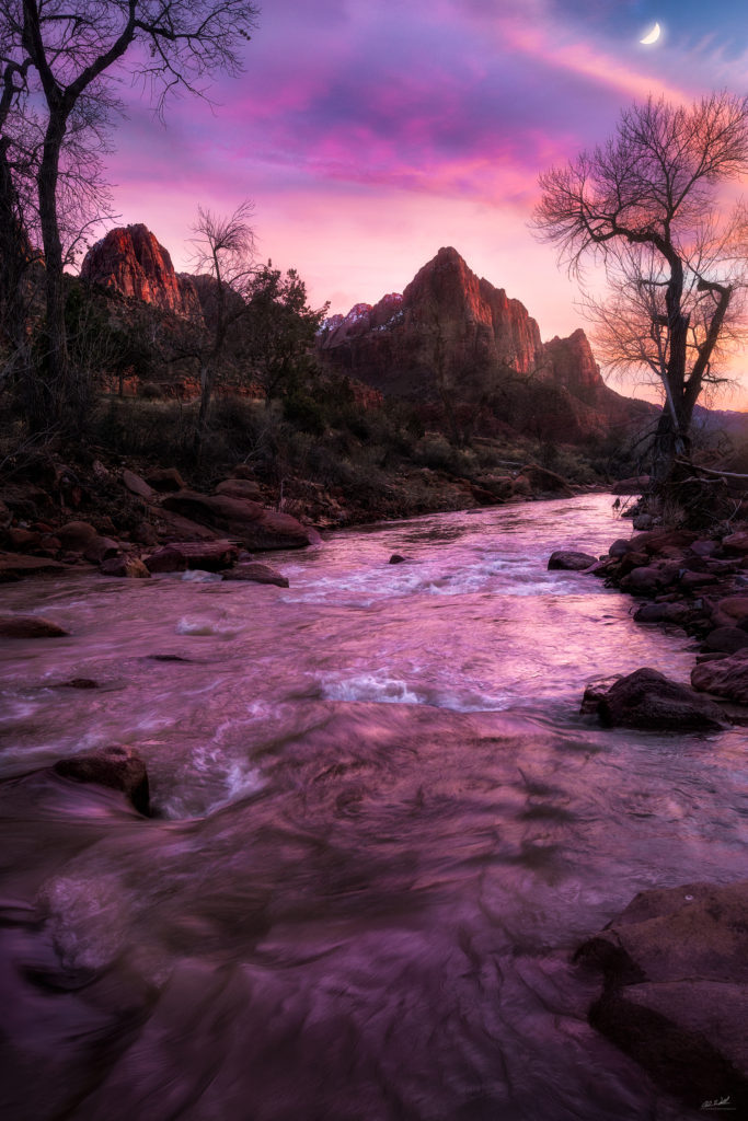 The sunset that is photographed here over the Virgin River in Utah was probably the single most gorgeous one I had seen in a very long time. The higher clouds seemed to glow with rich and vibrant colors as the light began to fade and twilight took hold. On this particular night I was lucky enough to catch some amazing light on the lower clouds as well which is rather rare.
Low clouds can be a huge pain to deal with; especially out on the coast. The marine layer that envelops the coast during the summer and late fall can wreak havoc with your plans to chase epic light. Once the sun dips below the marine layer your chances are next to none for amazing light. On the flip side lower cloud decks can also provide for some amazing conditions as well though! A lot of the most gorgeous sunsets that happen in tropical areas or out on the coast occur when the sun dips below the cloud deck and hits this narrow strip of clear sky right before the horizon and lights up the underside with brilliant shades and hues. Skies like this are often associated with the exit and entrance of strong storms in the Pacific Northwest.
If you’re looking for amazing light stay clear of the marine layer and chase the storms. The instability in the atmosphere before and after a large storm can really add to not only the variety of clouds but also the textures that are created due to wind shear in up and down drafts in the atmosphere. Look for the high fluffy and feather like clouds proceeding a storm as well as low cloud decks just above the horizon. If you see these conditions taking shape prior to sunset odds are you’re going to get quite a show.
If you see a marine layer off the coast don’t loose hope but also don’t hold your expectations too high! When I have to deal with a marine layer I often use my time to shoot moody twilight/star images or soft pastels that the winter storms can create.
Chase the Storms
If there’s one thing that I’ve realized over my brief time as a photographer it’s that storms are a landscape photogs best friend. The thunderstorms and unstable air that follow cold fronts offer up some of the coolest weather conditions that you can find! I’ve found myself in the belly of some pretty nasty thunderstorms a handful of times and my persistence paid off in spades. If you check the satellite images and see speckled clouds heading into the area proceeding a front grab your camera gear and head to your favorite location because chances are that the instability in the atmosphere will yield epic light, rainbows, lightning or just crazy cloud formations that can add some serious interest to your shot.
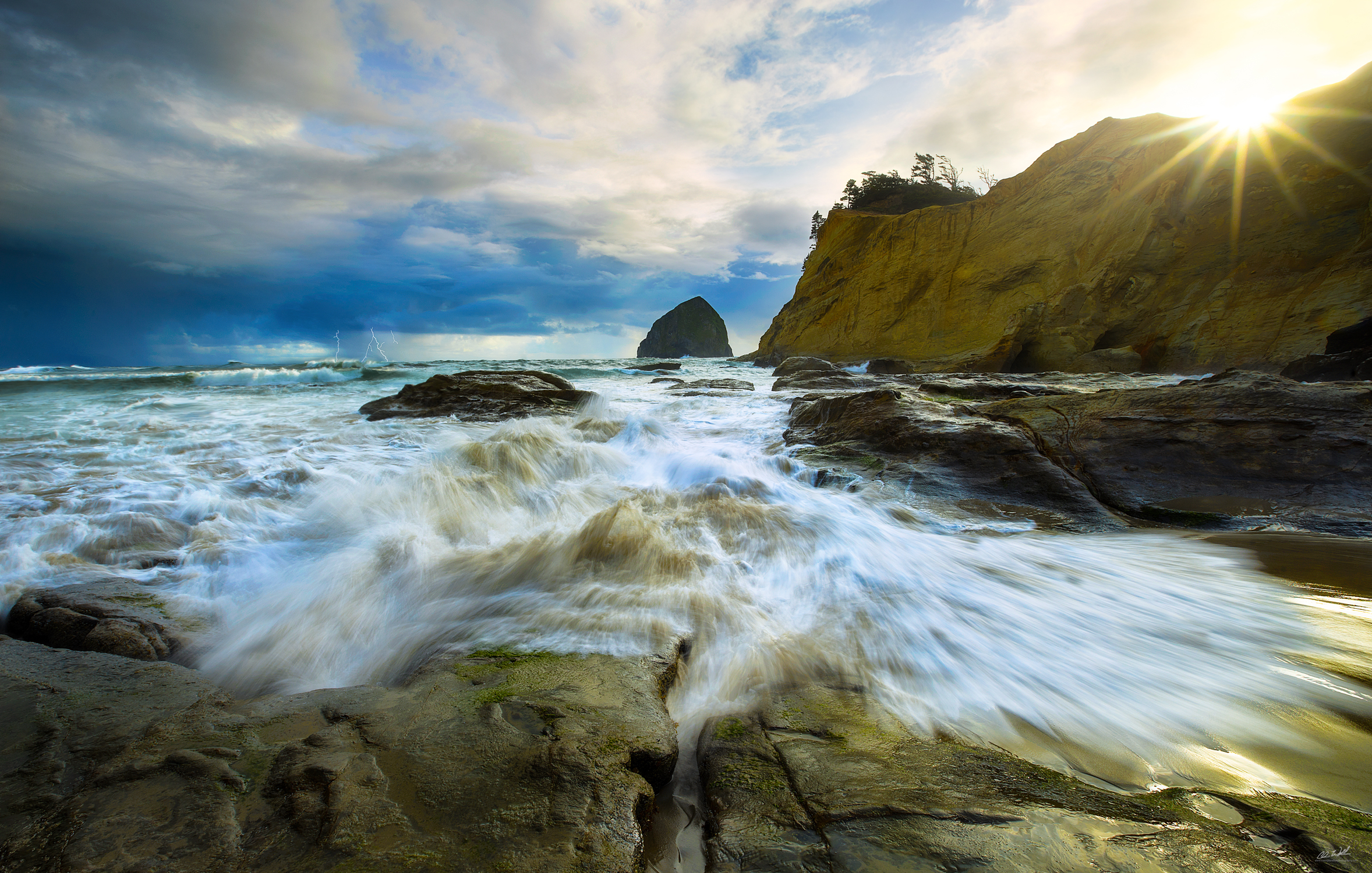
One of my favorite storm chasing stories came from an early spring trip to the Oregon coast. I left fairly early on a Friday morning in a valiant effort to make it down to Cape Kiwanda to shoot the sunset because the weather was looking prime to either be a complete bust or something really special. We had an offshore low spinning in some really unsettled weather in the form of a few nasty thunderstorms and some heavy rain/sleet/hail showers which made the drive down to Portland a ton of fun to say the least. Once I hit PDX a hopped over to HWY 101 to make a few pit stops on the way down the coast. I finally hit Kiwanda in the late afternoon and managed to get about 45 minutes of sleep in before heading out in the late afternoon light to set up for what I was seriously hoping to be some epic light.
I checked my NOAA app and I was elated to see that thunderstorms were everywhere and the rain showers were pummeling the coast as the sun fought through to illuminate the area. I shot a set on the rocks down below the dunes with lightning striking in the distance and then made the climb over the massive sand dune near the haystack to shoot some of the more well known compositions in that area. I shot some moody wave action on the cliffs for a bit before turning my attention to one of more well known comps of the Haystack made famous by guys like Dyar and Noriega when all of the sudden BOOM. Thunder cracked over head and rain started coming down.
For whatever reason I decided to turn around and check out the cliffs directly behind me and they were absolutely going off. The sun had dropped right below the thunderhead and soaked the cliffs in warm ominous light. I scrambled down the slick clay (be forewarned it’s slick as hell especially when wet) shot over to the other side of the bluff and set up shop praying to the photography gods that I could get off a few clean shots. The light lasted maybe 5 minutes before being swallowed up by the incoming weather. It was definitely something I will never forget and it was one hell of a way to start my trip down the coast.
Stories like that are what influence my desire to get out and shoot no matter what the weather forecast is. I don’t have a lot of free time so I can’t let weather dictate whether or not I make a planned trip but I do let it guide me to a location or a composition that might be made favorable by epic weather conditions.
Here’s another image from the same trip taken an hour or so earlier as the sun was setting. Lightning struck just off the coast and I was lucky enough to catch a few bolts on camera.
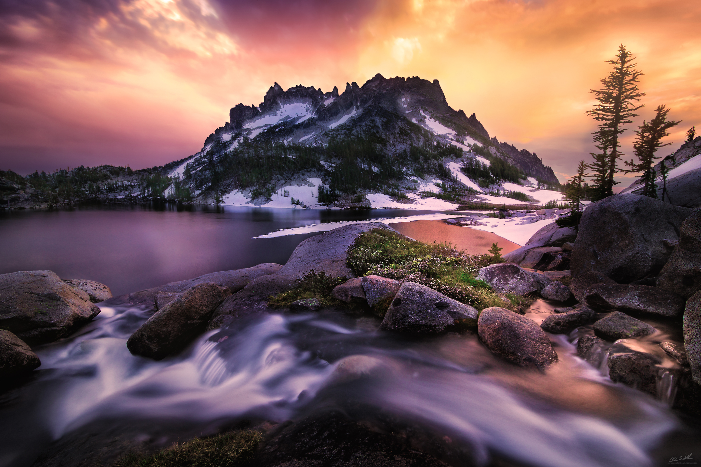
Storm chasing can be fun but it can also be extremely dangerous. One of my more memorable trips came from the Enchantments of Washington State. I was in my 4 season bivvy camped out on some exposed granite slabs above Perfection Lake when one of the most intense thunderstorms I’ve ever experienced rolled through.
Let me preface this by saying I’ve been through some pretty damn intense storms but this one genuinely freaked me out a bit. The thunder and lightning were pretty much right on top of each other and our awesome choice to set up camp was right in the middle of it. Awesome. I seriously contemplated getting out to snag some shots, but quickly realized what a horrible idea that was being that we were so exposed so I decided to hunker down. My next fear was that the stream I was next to was going to overflow and wipe me out; thankfully that didn’t happen but the amount of rain that was coming down sure as hell made me think otherwise. It was pretty epic to say the least and to this day I still don’t know how we managed to get out of it unscathed. Never a dull moment in the Enchantments.
The bottom line is this: take precautions and always listen to your gut while shooting lightning or powerful storms. If it doesn’t feel right then it probably isn’t and it’s best to get the hell out of there and live to fight another day. No photograph is worth your safety or the safety of others.
The Take Home Message to Predicting Sunsets and Sunrises:
- Check the forecasts and do your research
- The NOAA radar app, the Cliff Mass Weather Blog and the National Weather Service are all great resources! Use them!
- Follow the Cold Front and pay attention to the jet stream
- High Pressure means CLEAR skies
- Avoid the Marine Layer on the coast (mostly summer/fall)
- Look for unsettled weather patterns and chase them!
- Stay safe and be prepared!!